
Mission Valley Flooding: San Diego River Levels
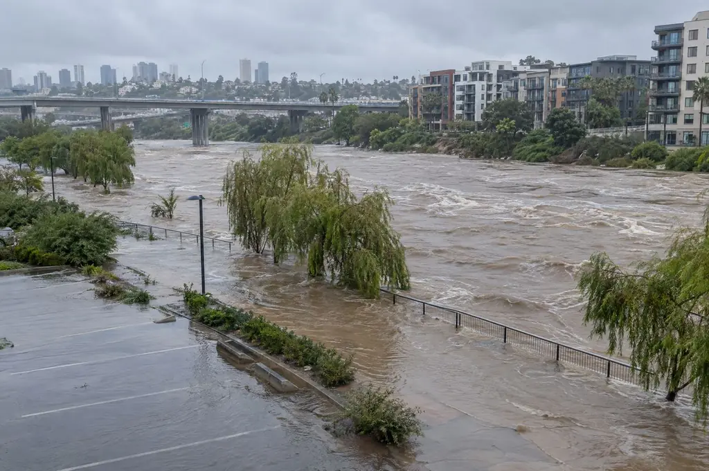
Mission Valley flooding follows the San Diego River gauge at Fashion Valley. Low roads around the mall take water at 7.5 feet, the mall garages and the Town and Country lot at 10, Hotel Circle North and Mission Center Road at 13.5, and homes and businesses across the valley at 16.5 feet, according to the National Weather Service.
By San Diego Water Damage Watch, a phone line paid for connecting calls (how it works)
Updated
Key facts
- NWS flood categories for the San Diego River at Fashion Valley: action 7.5 ft, minor 10 ft, moderate 13.5 ft and major 16.5 ft. NWS National Water Prediction Service: San Diego River at Fashion Valley (FSNC1)
- The highest crest on the gauge's current datum is 16.3 feet on Feb. 21, 1980, just under major flood stage. NWS National Water Prediction Service: San Diego River at Fashion Valley (FSNC1)
- The Fashion Valley gauge reached minor flood stage on New Year's Day 2026, when 2.08 inches fell at the airport. CW3E (Scripps Institution of Oceanography): Atmospheric Rivers, Flooding, and the Changing Climate in the San Diego Region (March 19, 2026)
- New flood risk maps along the San Diego River took effect on March 3, 2026. City of San Diego Stormwater: Floodplain Management
The San Diego River right now
The San Diego River at Fashion Valley read 2.94 feet at Nov 18, 8:15 AM, 4.6 feet under action stage. Readings are provisional USGS data.
The San Diego rainfall totals page reloads the gauge in your browser. For the official record, see the USGS gauge page and the NWS forecast for the gauge.
What floods at each river level
| River level | Stage | What the NWS says floods |
|---|---|---|
| 7.5 ft | Action stage | Avenida Del Rio and other low roads around Fashion Valley Mall start to take water. |
| 10 ft | Minor flood stage | The bottom levels of the Fashion Valley Mall garages take 1 to 2 feet of water, and water spreads onto the Town and Country hotel lot. |
| 13.5 ft | Moderate flood stage | Parts of Hotel Circle North go under, Qualcomm Way may close and Mission Center Road carries 2 to 3 feet of moving water. |
| 16.5 ft | Major flood stage | Most unelevated roads and intersections in Mission Valley flood, with widespread damage to businesses, homes and roads up to Highway 163. |
Source: NWS National Water Prediction Service: San Diego River at Fashion Valley (FSNC1), impacts list.
Past crests at Fashion Valley
| Date | Crest | Note |
|---|---|---|
| January 27, 1916 | 19.30 ft | Highest on the NWS list, measured on an older datum. |
| February 21, 1980 | 16.30 ft | Highest on the current datum, just under major flood stage. |
| February 28, 2017 | 14.15 ft | Evening of Feb. 27 in San Diego. |
| December 22, 2010 | 14.01 ft | County flood declaration DR-1952 covers these storms. |
| March 6, 1995 | 13.47 ft | |
| January 16, 2023 | 12.77 ft | The most recent of the six highest crests on the NWS list. |
Source: NWS historic crests for FSNC1. The rain behind each crest is on the San Diego rainfall and storm history page.
Flood claims in the river ZIP codes
These three ZIP codes run along the San Diego River from Old Town up through Mission Valley to Grantville. Each counts claims for the whole ZIP, not only the blocks by the river.
| ZIP | Neighborhoods | NFIP claims | Home flood policies |
|---|---|---|---|
| 92108 | Mission Valley | 53 | 47 |
| 92110 | Bay Park, Morena, Old Town, Midway | 45 | 83 |
| 92120 | Allied Gardens, Del Cerro, Grantville | 61 | 56 |
Source: FEMA OpenFEMA NFIP Redacted Claims v3 and Policies v3, calculated by San Diego Water Damage Watch on November 14, 2026; policies in force on September 1, 2026. Every ZIP is on the San Diego flood map by ZIP.
If river water reaches a home or garage
- Leave low garages and roads once the river passes action stage, and call 9-1-1 if anyone is trapped.
- Report flooding to the City's emergency dispatch center at 619-527-7500.
- Treat river floodwater as contaminated, and photograph the water line before anything is moved.
- The flood cleanup page covers what can be dried and what comes out, and the San Diego flooding page covers the rest of the city.
Sources: City of San Diego: Storm Preparedness; Mold, moisture and your home: the EPA's brief guide.
Questions San Diego homeowners ask
At what river level does Mission Valley flood?
The National Weather Service sets action stage for the San Diego River at Fashion Valley at 7.5 feet, when Avenida Del Rio and other low roads near the mall start to take water. Minor flooding begins at 10 feet and major flooding, with damage to homes, at 16.5 feet.
How high has the San Diego River crested in Mission Valley?
The highest crest on the NWS list for the Fashion Valley gauge is 19.3 feet in January 1916, on an older datum. On the current datum the crest list starts with 16.3 feet on Feb. 21, 1980.
Has Mission Valley flooded recently?
The gauge crested at 12.77 feet in January 2023, above minor flood stage, and reached minor flood stage again on New Year's Day 2026. In October 2026 the NWS forecast an 8.1-foot crest, at action stage, during Post-Tropical Cyclone Rachel.
Is my Mission Valley address in a flood zone?
Check the address on FEMA's Flood Map Service Center. New flood risk maps along the San Diego River took effect on March 3, 2026, so a zone you looked up before then may have changed.
Cite this page: “Mission Valley Flooding: San Diego River Levels.” San Diego Water Damage Watch, https://sandiegowaterdamagewatch.com/mission-valley-flooding/. Updated November 14, 2026.